Written by JCAFA
Many of you will know that Chalice Mining’s Gonneville project is currently undergoing an environmental assessment through a Public Environmental Review (PER), overseen by the Environmental Protection Authority (EPA).
This review, which will finally give the public a chance to have our say and submit comments, was due to be released by June. We are now into July, and so far, nothing has been made public. However, we will be ready to make sure you know about it and to help support your submission.
While we wait for the official environmental review, developments are happening behind the scenes. Recently, several Chittering residents received notices that the water pipeline and power infrastructure could traverse right through their private properties as part of the project.
The proposed corridor has the potential to affect numerous rural and rural residential properties. The full extent of impacted landholders remains unclear because a detailed corridor alignment has not been publicly released.
Understandably, local landowners are deeply concerned about the prospect of a mining corridor cutting directly through their land. Proximity to homes, wildlife habitat, and rural-residential communities are raising serious questions.
Some of these blocks are currently under strict Shire covenants and are legally restricted from clearing trees within these designated preservation areas. It seems a tad ironic that a mining company can have license to clear those protected trees.
This proposed corridor would also directly affect a land-titled Tree Preservation Area, home to recorded Carnaby’s Black -Cockatoo hollows and vital native vegetation.
Below, you’ll find a map of the corridor provided by the Chittering group, formed as a result of this collective concern. As a formal map has not been supplied, this has been created based on what has been gleaned by the residents.
We deserve clarity on what is being planned for our region and when the community will actually get to see the environmental data.
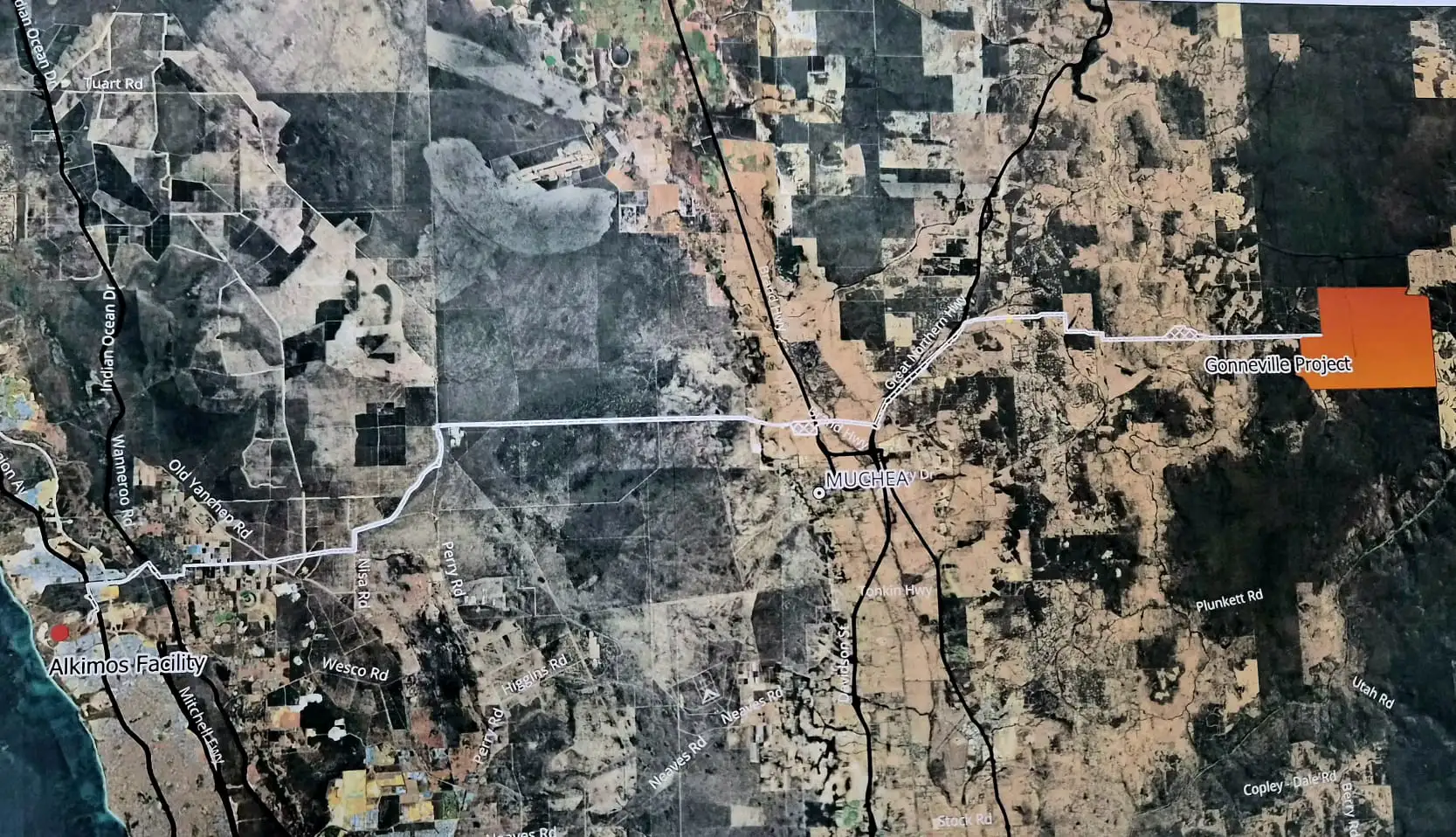
A map of the proposed infrastructure corridor. As a formal map has not been supplied, this has been created based on what has been gleaned by the affected residents.
Social license is everything to a mining company – make noise:
👉 Join the Chittering FB group ProtectOurValley.Chittering
👉 Use your voice – write an email to the EPA and continue to write to ministers asking for clarity and updates.
👉 Spread the word. Share our social posts and write your own.
👉 Stay informed and get notifications about the assessment:
–EPBC, register and subscribe
-EPA WA mailing list
More info:
echonewspaper.com.au
nvnews.com.au